Skip to content
Niagara river view with big rocks

Resources

Resource Library

Reports, assessments, fact sheets, and outreach materials produced through the Niagara River Remedial Action Plan.

Filter by category or project, or search for a specific document. All files open as PDFs.

Showing 64 of 64 documents

2022 Technical Reports

Niagara River Mussel Biomonitoring Program: Long-term Water Quality Trends 2012-2018

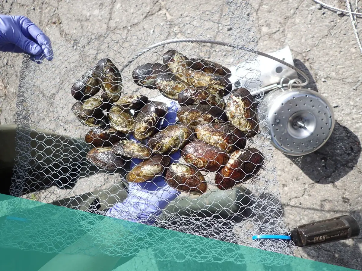
Since 1983 the Ontario Ministry of Environment, Conservation, and Parks (MECP) has been committed to the biomonitoring of contaminants in the Niagara River using caged mussels (Elliptio complanata) and more recently using passive samplers and polyethylene devices as part of Ontario’s commitment to the binational Niagara River Toxics Management Plan (NRTMP). These studies have provided information on suspected contaminant sources and source areas between Fort Erie and downstream at the mouth of Niagara-on-the-Lake on both the Canadian and American sides of the river.

Download PDF (opens in a new tab)

2021 Technical Reports

King Street Investigation & Rehabilitation Final Report 2018-2020

The report provides an analysis of water quality samples from the storm sewer collection system which discharges to Queens Royal Beach (QRB) located in the Niagara River Area of Concern (AOC), having historical water quality problems. A water quality monitoring program, extensive field investigation program, and rehabilitation of identified infrastructure deficiencies were enacted within the drainage area from 2018 to 2020.

Download PDF (opens in a new tab)
2021 Technical Reports

Queen’s Royal Beach Water Quality: 2020 Monitoring and Data Analysis Report

Summary of 2020 water quality results collected at Queen’s Royal Beach. Over the course of the 2020 sampling season, 90.5% of samples collected at Queen’s Royal Beach (QRB) met the recreational water quality guideline for safe swimming (200 E. coli colony forming units/100 mL or less). Suggested citation: Laufman K. and I. Patel. 2021. Queen’s Royal Beach Water Quality 2019 Monitoring and Data Analysis Report. Town of Niagara-on-the-Lake, Ontario, Canada.

Download PDF (opens in a new tab)
2020 Technical Reports

Queen’s Royal Beach Water Quality: 2019 Monitoring and Data Analysis Report

Summary of water quality results collected at Queen’s Royal Beach in 2019. Over the course of the 2019 sampling season, 81.1% of samples collected at Queen’s Royal Beach (QRB) met the recreational water quality guideline for safe swimming (200 E. coli colony forming units/100 mL or less). Suggested citation: Laufman K. and P. Moura. 2020. Queen’s Royal Beach Water Quality 2019 Monitoring and Data Analysis Report. Town of Niagara-on-the-Lake, Ontario, Canada.

Download PDF (opens in a new tab)
2018 BUI Assessments and Redesignations

Re-Designation Report: Eutrophication or Undesirable Algae in the Niagara River Area of Concern

The report includes the technical assessment and all public engagement that supported the change of status of the Eutrophication or Undesirable Algae BUI in the Niagara River to ‘Not Impaired’ (from ‘Impaired’). The Canada-Ontario Agreement Annex 4 Co-leads formally confirmed the ‘Not Impaired’ designation in May 2019.

Download PDF (opens in a new tab)
2018 BUI Assessments and Redesignations

Status Assessment Report: Phytoplankton and Zooplankton Populations in the Niagara River Area of Concern

The report includes the technical assessment and all public engagement that supported the change of status of the Phytoplankton and Zooplankton Populations BUI in the Niagara River to ‘Not Impaired’ (from ‘Requires Further Assessment’). The Canada-Ontario Agreement Annex 4 Co-leads formally confirmed the ‘Not Impaired’ designation in January 2019.

Download PDF (opens in a new tab)
2017 Technical Reports

Lyons Creek East (Niagara River, Ontario) Area of Concern: benthic conditions in 2015 and temporal trends from 2002 to 2015

Report on the results of sediment chemistry, benthic community structure, bioaccumulation in native invertebrates, and sediment toxicity from fall 2015 sampling at Lyons Creek East and three nearby reference sites. Analysis also includes trends from 2002-2015. Prepared by Danielle Milani and Lee Grapentine, Environment and Climate Change Canada, Water Science and Technology Directorate, March 2017

Download PDF (opens in a new tab)
2012 Technical Reports

Niagara River Watershed Fish Community Report

The purpose of this project was to describe resident (June to Oct) fish communities (fish species and relative abundances) in the Niagara River Area of Concern watershed in relation to indicators of habitat quality, ecosystem quality and overall biologic diversity. Citation: Yagi A.R and C. Blott. 2012. Niagara River Watershed Fish Community Assessment (1997 to 2011) Ontario Ministry of Natural Resources unpublished report 168pp + appendices

Download PDF (opens in a new tab)
2011 Technical Reports

Lyons Creek East Evaluation of Administrative Controls

The purpose of the report was to investigate a series of questions associated with the Monitored Nature Recovery approach for Lyons Creek East, and to recommend a management framework that harmonizes administrative controls to ensure that human activities did not disturb and re-suspend the contaminated sediment. Prepared by French Planning Services for the Niagara Pensinsula Conservation Authority.

Download PDF (opens in a new tab)
2011 Admin Protocol

Lyons Creek East Monitored Natural Recovery Administrative Controls Protocol

The Lyons Creek East Monitored Natural Recovery Administrative Controls Protocol is an administrative tool that establishes principles and procedures to ensure contaminated sediment in the Lyons Creek East Contaminated Sediment Area (see map on page 4) is not disturbed, exposed or re-suspended. The protocol is supported by local, regional, provincial, and federal organizations.

Download PDF (opens in a new tab)
2011 Technical Reports

Lyons Creek East PCB Decay Report

This report by Golder & Associates reviews the theoretical decay of Polychlorinated Biphenyls (PCBs), assesses available data for PCB decay in Lyons Creek East, and describes the predicted decay of PCBs in Lyons Creek East. The study predicts that based on a range of dechlorination rates provided by Magar et al. (2005b) from their work at Lake Hartwell, it could take 41 years at the average rate and up to 109 years at the maximum rate. It is not known whether the rate of PCB decay is similar to the rate of decay measured in Lake Hartwell.

Download PDF (opens in a new tab)
2010 Technical Reports

Monitoring & Assessing Marsh Habitat Health

Bird Studies Canada final project report to assess AOC wetland quality and enhance long-term volunteer monitoring within the region. The primary goal of this project was to integrate Marsh Monitoring Program bird and amphibian data with limnological and aquatic macroinvertebrate data to provide a multi-parameter assessment of wetland health for the Niagara River AOC to inform the current status of BUI #3 (Degradation of Fish & Wildlife Populations).

Download PDF (opens in a new tab)
2010 Technical Reports

Current Status and Trends of Aquatic Wildlife in the Niagara River (Ontario) Area of Concern

This report focused on the status of aquatic wildlife, specifically those species monitored by the Canadian Wildlife Service (CWS), which feed predominately from the aquatic ecosystem in the Niagara River AOC. The study looks at contaminants found in several species: Colonial waterbirds, Snapping Turtles and their eggs, and American Mink. Findings were relevant to delisting criteria for some of the wildlife-related beneficial use impairments (BUIs) and results were used to assess the status of these BUIs.

Download PDF (opens in a new tab)
2009 Technical Reports

Niagara River Upstream/Downstream Program Report: Concentrations, Loads and Trends

Results from the Niagara River Upstream/Downstream program to measure the concentrations/loads and trends of contaminants in the river, 2001-02 & 2004-05. Data are compared to the most stringent water quality criteria available from the four agencies, to provide an indication of potential impairment of beneficial uses. Use of these data for any other purpose is at the discretion of the user.

Download PDF (opens in a new tab)

2007 Technical Reports

Lyons Creek East Human Health Risk Assessment (HHRA)

The Human Health Risk Assessment (HHRA) conducted for Lyons Creek East focused on potential exposure to PCBs in the study area. A community survey was conducted with the participation of residents in the Lyons Creek East study area to establish the number of people who catch and eat fish and game from the area, as well as use the creek recreationally. An assessment of both dermal exposure to PCBs and exposure to PCBs through consumption of fish was conducted. Based on the exposure estimates used in this assessment, the results suggest that remediation of the Lyons Creek East study area to address potential human health concerns is not warranted.

Download PDF (opens in a new tab)
2007 Technical Reports

Lyons Creek East Wetland Inventory & Monitoring Study

A detailed inventory of wetland and aquatic features of the Lyons Creek East wetlands. This study incorporated existing background data, remote sensing and field inventories of vascular plants, vegetation communities, breeding amphibians, and breeding birds to catalogue the terrestrial and aquatic resources present, establish baseline conditions, and identify sensitive features and functions.

Download PDF (opens in a new tab)
2007 Technical Reports

Lyons Creek West – Human Health Risk Assessment

A Human Health Risk Assessment (HHRA) was undertaken to determine the potential health risks for people who may come into contact with contaminants that originate from Lyons Creek West. The HHRA for Lyons Creek West was focused on the presence of PCBs and metals in the soil and sediment at the site. The assessment concluded that exposure to contaminants in the Upland area and in sediments in the Wetland area would not pose a potential concern for human health, based on the exposure estimates used in this risk assessment.

Download PDF (opens in a new tab)
2005 Technical Reports

Biomonitoring Study of Lyons Creek East (2002-2003)

A joint study was undertaken by Environment and Climate Change Canada, and the Ministry of the Environment, Conservation and Parks to address and document the sediment and water quality in Lyons Creek East. The study was undertaken in 2 parks; 1. a screening survey to identify areas with elevated PCBs, and 2. a survey that included sediment cores, caged mussels, and fish collections to understand the contamination of PCBs within the ecosystem.

Download PDF (opens in a new tab)

2005 Technical Reports

Niagara River Sediment Study Phase 3

Following Phase I/II, to review sediment conditions at 12 sites within the Niagara River Area of Concern, the focus of this study was to determine whether additional investigation was needed at any of the sites with a view towards identifying those areas where remediation may be requried. Three sites were identified, Lyons Creek West; Welland River - Port Robinson to Chippawa Power Canal, and Frenchman's Creek.

Download PDF (opens in a new tab)
The successes of the Niagara River Remedial Action Plan would not have been possible without the cooperation of various levels of government and the active involvement of the public.